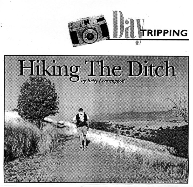
I talked up my scheme, telling friends about the spectacular scenery of the foothills of the Santa Rita Mountains. The hike, I added, would be mostly flat, with a total distance of 14.3 miles. I even promised little "history moments" with interpretive signs and additional fascinating details from my research. As a final enticement, I told them we would end the hike at the adobe buildings of historic Kentucky Camp, headquarters of the Santa Rita Water and Mining Company, now being restored by the Forest Service with the help of the Friends of Kentucky Camp.
I managed to convince two friends -- Linda Cross and Jo Haslett -- to join me. Linda's friend, Bill Gray, dropped us off at the Gardner Canyon Trailhead at 9 a.m. on February 15. Jo's husband, Glenn, planned to pick us up at Kentucky Camp late that afternoon.
"I thought you said the trail was flat," Linda comments ten minutes into the hike as we climb the Gardner Canyon Trail. "Almost flat," I counter, as we make our way the 1.2 miles to the Walker Basin Trail intersection. This is the steepest climb of the entire hike -- from 6,340 feet at the trailhead to 6,720 feet at the intersection. It is also an introduction to a remote and beautiful area of the Santa Rita Mountains. Tall pines shade our path and there is a evidence that bears have been this way recently. Our plan, if we see a bear, is to stand our ground, look the bear straight in the eyes, and scream. We hope we don't get the opportunity to put this plan into action.
The Walker Basin Trail circles above Big Casa Blanca Canyon and is mostly level, with a few minor ups and downs. When we cross the major drainage at the head of the canyon, we find rusted pieces of equipment that could be from one of several sawmills that operated in this area in the 1870s and '80s. Lumber brought a high price in Tucson and men risked Apache attacks to make substantial profits. Past the site we get the first of many views that are the reason I return to this trail again and again. After 1.5 miles on the Walker Basin Trail we turn left on a newly developed section of the Arizona Trail. We stop often to look at the bald summit of Mount Wrightson, the high point of the Santa Ritas, silhouetted against the bright blue sky. We'll climb it another day. For now we switchback steeply down to Bear Spring where I play tour guide for the first "history moment."
Masonry still remains where Casa Blanca Creek once entered the ditch. Designed by a California mining engineer, James Stetson, the ditch worked on the principle that as long as the source of the water was higher than its eventual destinations, and it never rose above that elevation, gravity would deliver the water. Here at Bear Spring the elevation is 5,500 feet. In Boston Gulch the elevation is 5,100 feet, so despite ups and downs, never higher than the beginning elevation, the water made it to its destination during the month the system operated. Today the system is dry, but we imagine how it must have looked when the water was flowing.
No one complains as we walk along the ditch, known officially as the Casa Blanca Ditch. Although much of the original six-foot-wide ditch has silted in over the years, it is still obviously a ditch. We stop to examine one of five overflow gates. Stetson insisted on using California redwood and there are still scraps of timber near the gates. After 2.5 miles of pleasant walking, we come to a tunnel. This nearly 1,000 foot tunnel connected the Casa Blanca Ditch with Gardner Canyon and the rest of the water system. When workers were digging the tunnel, they intercepted a spring. We climb the short, steep hill above the tunnel and drop down to Gardner Canyon Road where a small round tank collects water from what is now called Tunnel Spring. At this point, the water left the ditch and flowed into Gardner Canyon Creek.
Our route follows the road. By now, it is 1:15p.m., and on these short winter days-time is a concern. Jo wonders if we will make it to Kentucky Camp before dark. We walk down the road for one mile to rejoin the trail, which cuts off to the left. "Seven more miles!" Linda exclaims, as she reads the large metal sign. "This sign is wrong," I explain. "From here to Kentucky Camp is more like 4.5 miles." We leave the road and cross Gardner Canyon Creek. An interpretive sign points out Stetson's Dam. Little remains of the 110-foot-high dam built to store water to use in the hydraulic operations, but at one time the dam backed up a small lake.
During a snack break by the dam, I deliver on my promise to provide some "fascinating details." On May 20, 1905, Stetson left his home in the mining camp of Greaterville to come to Tucson to attend the board of directors meeting of the Santa Rita Water and Mining Company. He checked into the Santa Rita Hotel around noon and climbed the stairs to his room , number 319. The son of a painter working at Ronstadt's Hardware across the street from the hotel later reported seeing a man sitting on a windowsill on the third floor wearing only his trousers and undershirt. The maid cleaning room 219 heard a thud on the windowsill and looked up to see a body flying by the window. As reported in the next day's Arizona Daily Star, "When picked up, Mr. Stetson was a corpse."
Were there financial problems that Stetson did not want to disclose at the next day's board of director's meeting? So much so that he jumped to his death? Or did someone, perhaps wanting to keep Stetson silent, push him out the window? Or did he simply misjudge his seating and fall?
Whatever the answer, what remains of Steton's Dam is in a beautiful and serene setting. The water from the dam was diverted back into a ditch, now called the Gardner Canyon Ditch. We follow again the nearly level route. By now, nearly nine miles into the hike, we are tiring. The shadows lengthen and we step along, hoping to make Kentucky Camp while the sun still shines. This segment is one of the most scenic of the entire route. We hike above the Gardner Canyon Road with the cliffs of Big Casa Blanca Canyon on our right and views of the rolling Sonoita Valley in front of us.
In 30 minutes we come to a penstock designed to sift out gravel and other debris from the water before it entered a 24-inch pipe. This is the first time we encounter the pipe but from now on the system will alternate back and forth between a pipe and a ditch. We check out the penstock, peering into the pit where we can see the protruding pipe, all the while keeping an eye on the sun which is dropping quickly toward Mount Wrightson.
We descend a rather steep hill and imagine the water gathering speed as it dropped 200 vertical feet through the pipeline. As we cross the road, the trail is absolutely flat. The pipeline is covered with mounds of rock and looks like a collapsed prehistoric wall. We are now near Apache Springs Ranch and see buildings in the distance before we drop into the ravine cut by Cave Creek. Originally the pipe crossed the creek on wooden supports. A portion of rusting pipe still protrudes from the side of the ravine.
"We're getting close to the trailhead parking area," I point out as we climb out of the creek bed. We cross Gardner Canyon Road and rejoin the train, walking a few hundred yards to a parking area for the Arizona Trail. Several large interpretive plaques show the route of the trail. "What happened to the pipe?" Jo asks, as we start the short steep climb to the ridge, known as Dead Horse Mesa. I point out sections of the pipe at the base of the hill. "The water actually flowed up the hill to the top of the ridge," I explain. "The key is the elevation. The water dropped 200 feet from the penstock, but had to climb only 160 feet."
At the top of Dead Horse Mesa, Jo calls Glenn on my cell phone to tell him we are about an hour from Kentucky Camp and that he should be on his way. The water continued in the pipeline for a short distance before entering the Dead Horse Mesa Ditch. The views are again amazing, especially near sunset. "This is incredible," Linda says, as she looks across the valley.
After almost a mile, we leave the trail for a few yards to view the end of our hike along the ditch. Here a penstock sifted the debris once again as the water entered a pipe to cross Little Fish Canyon and drop into Boston Gulch where strong jets of water once sifted the gold from the gravel. Unfortunately, although the ditch system worked well, other problems in addition to Stetson's death forced the cessation of operations after the first month.
But here we are, high on a ridge overlooking Kentucky Camp with Glenn headed in our direction. We have no time to mull over the fate of the elaborate water system we have been following. We head along the trail to Kentucky Camp. The last mile is the longest. We have hiked nearly 14 miles as we drop into Boston Gulch. Kentucky Camp is 20 minutes away. The sky turns pink and the sun drops behind Mount Wrightston. We trudge up the last part of the trail, not stopping to read what is surely an excellent interpretive sign about Boston Gulch. I point out the holes dug by early miners and no one cares. We want to go home and soak in a hot tub. Finally, we see the buildings of Kentucky Camp. There's Glenn's van. We don't have to walk another step. We climb in the van, pull a cold drink out of the cooler, and relax. We have hiked the ditch!
Directions: To reach the Gardner Canyon Trailhead, follow Highway 83 toward Sonoita to Gardner Canyon Road (FR 92). Follow FR 92 to FR 785. Turn left and follow FR785 until it dead-ends at the trailhead. A portion of the route requires four-wheel drive. Kentucky Camp is also off FR 92. Nine-tenths of a mile after leaving Highway 83, turn right on FR163 and follow the signs to Kentucky Camp.
Caution: Do not attempt this hike unless you are an experienced hiker. Much of the 14.3-mile hike is in a remote area where obtaining emergency help is difficult. The hike should not be done during the summer months.
Betty Leavengood is a local freelance writer, DesertLeaf columnist and author of Hiking Guide to Tucson.